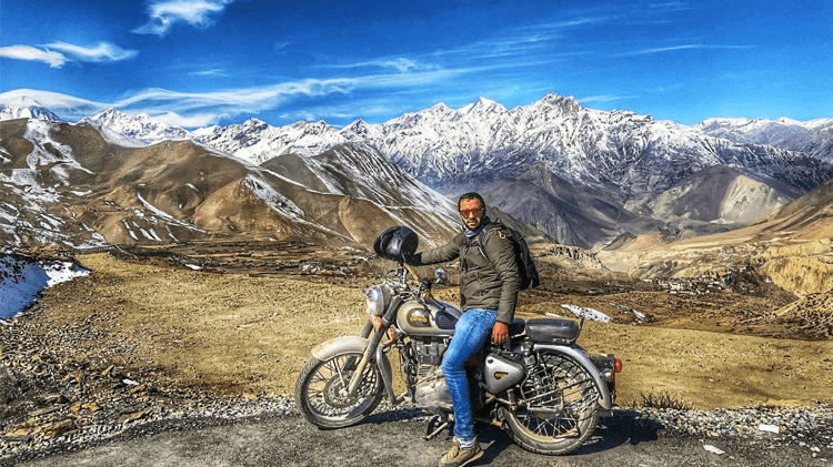
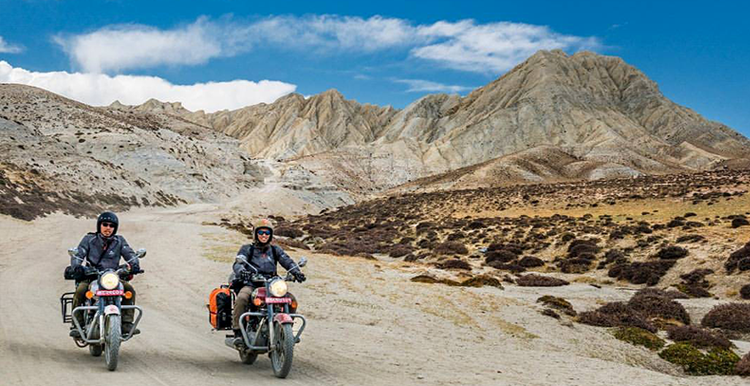
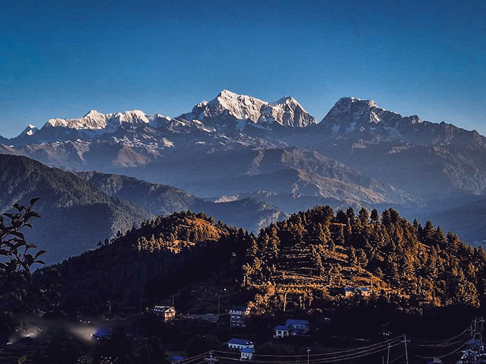
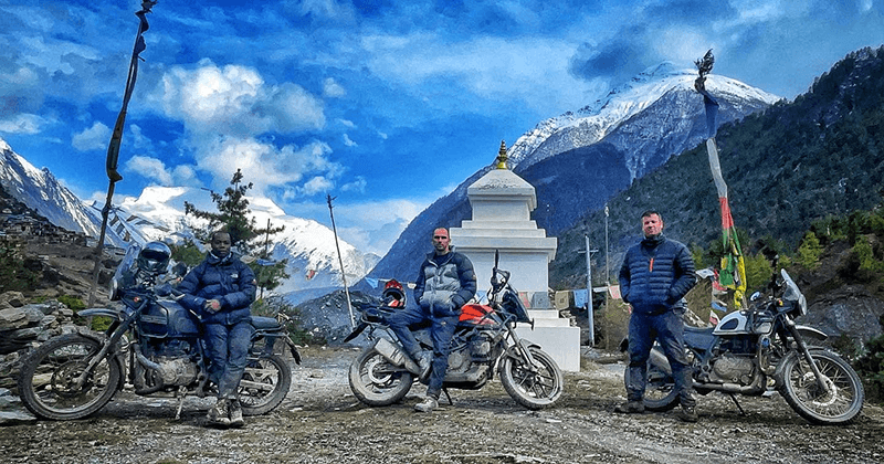
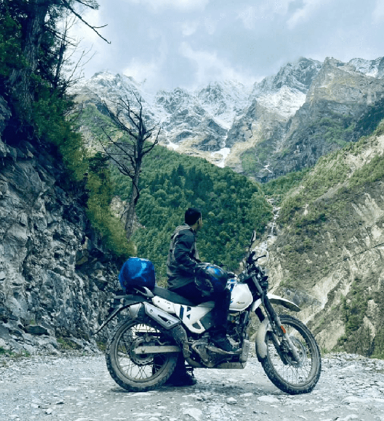
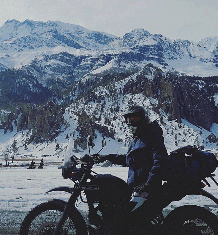
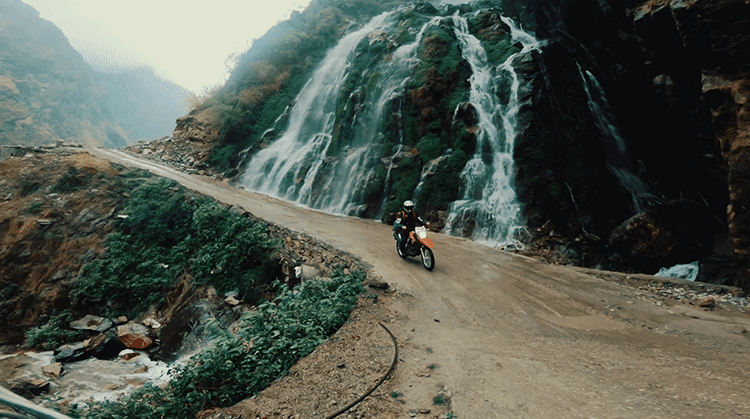
Trip Gallery
See the Route for Yourself
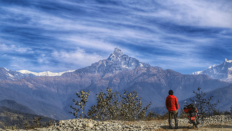
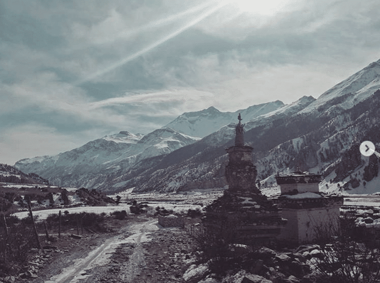
Real shots from the canyons, valleys, and high passes of the Manang motorbike tour.
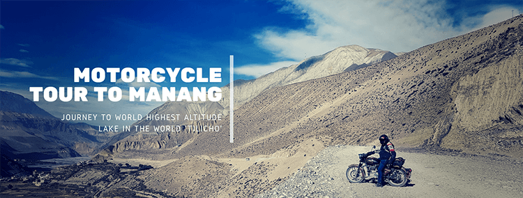
Ten days. 600km of raw off-road terrain. The world's highest altitude lake at 4,919m. Glaciers, canyon rivers, ancient Gurung villages, and the Annapurna massif at every turn — this is Nepal's wildest ride.
The Manang Motorbike Tour is one of Nepal's most demanding and rewarding off-road adventures. From the moment you leave the highway behind and drop into the Marsyangdi River Canyon, you're in a world defined by raw power — thundering glacier rivers, plunging waterfalls, and walls of mountain that block out the sky.
This is a journey of contrasts: the lush jungle terrain of the lower canyon gives way to the stark, dry, Tibetan-plateau feel of Manang Valley at 3,500m+. The same road that threads through dense forests near Besisahar arrives, days later, at the windswept shores of Tilicho Lake — the world's highest altitude lake at 4,919m, sacred to both Hindus and Buddhists and mentioned in the Ramayana.
In 10 days you'll cover roughly 600km through the Annapurna Conservation Area, passing through villages of the Gurung and Thakali people, stopping at ancient Buddhist monasteries, and climbing terrain that most vehicles simply cannot handle. This is no guided highway slog — it's proper adventure motorcycling at altitude.
Everything is taken care of: experienced local guide, fuel, permits (TIMS + ACAP), accommodation, meals, spare parts, and a dedicated mechanic. You bring the riding spirit. We handle the rest.
The world's highest altitude lake and a sacred site mentioned in the Ramayana. A pilgrimage destination and the ultimate high-altitude prize of the tour.
Nepal's most dramatic river canyon — glacial turquoise water, vertical cliffs, cascading waterfalls, and trails carved from the canyon wall itself.
Gangapurna, Annapurna II, III, and IV, Pisang Peak — a relentless procession of 7,000m+ giants framing the entire Manang Valley horizon.
Gangapurna Glacier and its lake are visible from almost every guesthouse window in Manang. Ice-blue melt water filling a bowl of rock at 3,500m.
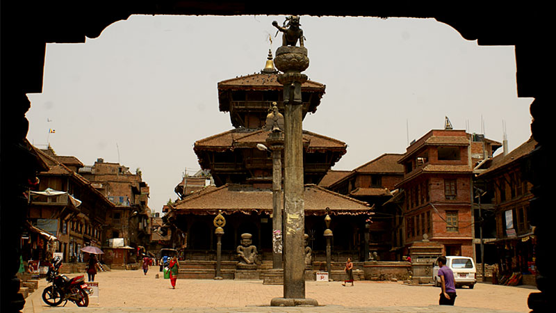
The communities of the Marsyangdi and Manang valleys — warm hospitality, ancient traditions, and a culture shaped by altitude and isolation.
Gompas perched above valley floors, prayer flags snapping in the wind, monks who've watched riders come and go for generations.
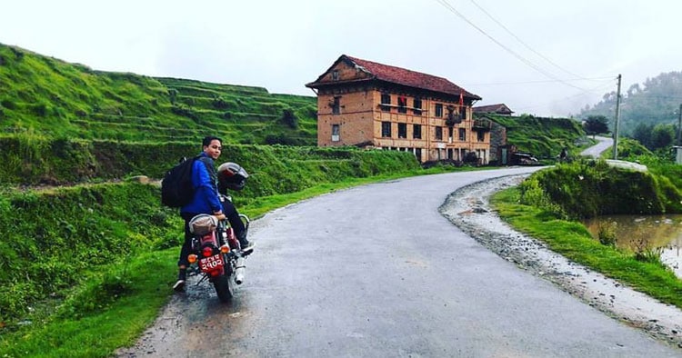
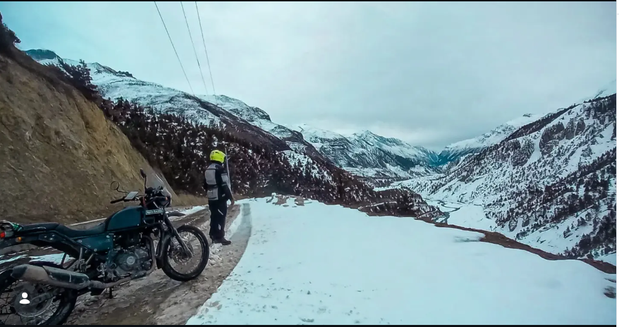
Rocky trails, river crossings, steep dusty climbs, and high-altitude plateaus. This is challenging ADV riding at its most authentic — no highway miles.
From lush subtropical jungle near Besisahar to alpine scrub and bare rock plateau near Manang — the full vertical range of the Himalayas in one ride.
Land in Kathmandu and let us take care of the airport transfer. Check into your Thamel hotel and meet your guide for an evening briefing — routes, gear check, weather, what to expect on the trail. Get a feel for your assigned bike. Tomorrow the canyon calls.
🛬 Arrive · Brief · Gear UpEarly breakfast and away. The Prithvi Highway west of Kathmandu is Nepal's main artery — quick, efficient, and already showing you terraced hillsides and the first mountain silhouettes. Turn north at Dumre and the landscape changes immediately: the road tightens, the river appears, and the mountains begin closing in. Besisahar is the gateway to Manang district and the start of the Annapurna Circuit. Tonight you sleep at the foot of what lies ahead.
🏍 First Ride · Canyon Gateway · Annapurna FoothillsThe gloves come off here. The first 32km is an undulating climb on a dusty, rocky trail — expect to hike sections of steep terrain near Taal village, a riverside settlement so dramatically beautiful it's been called "a piece of heaven." From Taal, the canyon narrows and the Marsyangdi River becomes a constant, roaring companion. Chame (2,710m), the Manang district headquarters, is a significant milestone — warm food, cold mountain air, and the knowledge that tomorrow it gets higher and wilder.
⛰️ Canyon Begins · Rocky Trails · Taal Village · Altitude GainsThe shortest day in distance, but the heaviest in altitude gain. The 31km from Chame to Manang climbs through forests of pine and rhododendron, past the dramatic rock faces of Paungda Danda, and into the increasingly arid high-altitude terrain that signals you've crossed into a Tibetan micro-climate. The Manang Valley opens suddenly — a wide, flat bowl of dry land ringed by some of the most dramatic mountain faces in Nepal. Gangapurna Glacier fills the horizon. Welcome to the high country.
🏔 High Valley Arrival · Glacial Views · Thin AirThe summit day. Manang village is the gateway to Tilicho Lake — at 4,919m, the highest altitude lake in the world and a deeply sacred site. In the Hindu epic Ramayana, Tilicho is named as the mythological Sarovar Lake, and pilgrims have made their way here for centuries. The landscape on the approach is elemental: bare rock, sky, ice, and the extraordinary stillness of altitude. The lake itself, backed by the Tilicho Peak (7,134m), is the kind of sight that makes riders go very quiet. Acclimatise overnight in Khangsar (3,514m).
🌊 World's Highest Lake · Sacred Waters · Summit AchievementA traverse day — east from Khangsar through the upper Manang valley floor to Pisang (3,734m), a traditional village split between upper (Tibetan-style flat-roofed houses above the canyon) and lower (more modern) settlements. Upper Pisang has one of the most photographed monastery views in the Annapurna region. The ride across the valley floor gives you different perspectives of the same mountains you've been riding towards — Annapurna II and IV, Pisang Peak, and the Manang Valley spread behind you.
🏔 Valley Traverse · Traditional Village · Monastery ViewsA long, rewarding descent back down through the Marsyangdi corridor toward Shyange. The scenery changes dramatically as you drop altitude — from the arid, rocky plateau of the high Manang region back into lush vegetation, jungle canyon, and the thundering sounds of the river far below. The local Sherpa communities along this stretch are among Nepal's most welcoming — expect impromptu chai stops and genuine curiosity about your journey. Shyange is a riverside village that makes a perfect base before the final push home.
🌿 Canyon Descent · Sherpa Villages · River SoundsA well-earned rest day. Shyange sits at the confluence of multiple mountain trails and river routes — there's hiking if you want it, or you can simply decompress. You've ridden to 4,919m and back through some of Nepal's most extreme terrain. The mountains are still there, the river is still roaring, and there's nothing pressing to do except be exactly where you are. Some days, that's the best part of any expedition.
♻️ Rest · Recover · Wander · ReflectThe final ride. Back on the highway, the landscape transforms from mountain wilderness to the busy terraced hillsides of the Prithvi corridor. You'll feel the difference in the air — warmer, thicker, carrying the familiar sounds of the valley. The sensation of re-entering city life after 8 days at altitude is something every rider recognises: a quiet satisfaction, a reluctance to arrive, and an already-forming plan to come back.
🏁 Final Stretch · Farewell Dinner · Until Next Time4,919m. World's highest altitude lake. Sacred in Hinduism and mentioned in the Ramayana. The undisputed summit of this journey.
The glacier and its meltwater lake are visible from Manang village — ice-blue water against a backdrop of 7,455m peaks.
Nepal's most dramatic river gorge — a churning glacial river flanked by canyon walls, waterfalls, and jungle vegetation.
The "piece of heaven" village in the canyon — a flat, green river plain surrounded by vertical rock walls and roaring waterfalls.
Ancient Buddhist gompas perched above the valley floor with prayer flags, butter lamps, and mountain views stretching to infinity.
One of the Annapurna region's most photographed viewpoints — a traditional gompa above the valley with a 360° mountain panorama.
The indigenous communities of the Marsyangdi valley — their food, language, and traditions are a living archive of Himalayan life.
Annapurna II, III, IV, Gangapurna, Pisang Peak, Tilicho Peak — the full Annapurna massif visible from the valley floor at once.
Real shots from the canyons, valleys, and high passes of the Manang motorbike tour.
Your home country licence works, or an International Driving Permit. Both accepted. Make sure it's valid before you fly.
Tilicho Lake sits at 4,919m. Consult your doctor if you have cardiovascular or respiratory conditions. Travel insurance with evacuation cover is strongly advised.
Bring your own complete gear — helmet, boots, gloves, riding suit with back protector. This is off-road terrain. No sugarcoating.
Strongly recommended. Mountain rescue is expensive. Ensure your policy covers high-altitude adventure riding.
Minimum 2 riders required. Solo riders are welcome to join a scheduled group. More riders = bigger group discount.
The route can be adjusted to your pace, interests, or fitness. Just mention it during booking and we'll make it work.
Natural events, weather, or road closures outside our control may affect the tour. Additional costs are borne by participants.
September–December and February–July are ideal windows. Avoid the monsoon months of July–August for off-road canyon riding.
The Manang Motorbike Tour departs year-round (outside monsoon). Minimum 2 riders per departure. Drop us a message and we'll build your perfect departure date.